by Ryan Hall, Y’all at X
We’re less than 36 hours out. The time for wondering is over.
After days of model volatility and shifting storm tracks, the guidance has finally started converging. Winter Storm Warnings and Watches now blanket areas from New Mexico to Virginia. Emergency declarations are in effect across multiple states. This is happening.
Here’s where we stand this morning.
The Northern Shift Is Real, But Limited
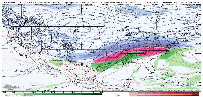
Yesterday I told you the models had gone north. Way north. The European model had shifted nearly 200 miles in 12 hours and other guidance followed.
That trend has held. The latest runs continue to show a more northern track than what we were seeing early in the week. The I-95 corridor from Washington to New
York is now firmly in the significant snow zone. That wasn’t on the table three days ago.
But here’s what changed overnight. The downstream tropopause vortex has trended toward a faster exit than some of the earlier guidance suggested. That sounds technical, but the practical effect matters. This is now predominantly a southwest flow warm air advection event rather than the classic overrunning setup some earlier model runs were showing.
What does that mean? Two things. First, it broadens the north-south extent of the heavy snow swath. More people see snow. Second, it lowers the maximum ceiling for snow totals in any single location. Instead of training bands dropping 18 to 24 inches on one unlucky city, the heaviest rates will gradually translate northeast. Still significant. Just more spread out.
This is a good reminder about analog years. Earlier this week, some forecasters were comparing this setup to February 5, 2010 or February 16, 2003. The large-scale pattern similarities were real. But those similarities were based on what models initially showed. The evolution since then has diverged. Don’t anchor too hard on historical comparisons when the actual synoptic setup keeps shifting.

— Ryan Hall, Y’all (@ryanhallyall) January 22, 2026
Continue Reading