by Sundance at The Conservative Treehouse
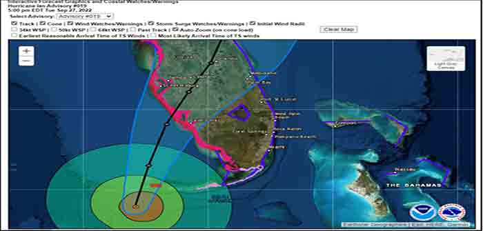
The projected path of Hurricane Ian, a category 4 storm, has now been narrowed. Landfall is anticipated just North of Cape Coral in the Punta Gorda, Port Charlotte area. Lee and Charlotte counties will likely feel greatest impact from Ian starting overnight through all day Wednesday, with eyewall entering Southwest Florida (SWFL) overnight Wednesday.
All preparations must be rushed to completion. Power outages will likely start sporadically happening early to midday tomorrow (Wed). Evacuation zones have been expanded due to increased storm surge prediction. Pay close attention to your local officials and local media. If you are staying in the Lee or Charlotte coastal area, now is the time to finish inside preparations. Local SWFL radar is now tracking storm [Local Media Link].

Boca Grande Pass, famous for exceptional Tarpon fishing, looks to be the immediate coastal area where the greatest wind driven storm surge will impact. Gulf water will be pushed up the Caloosahatchee and Peace rivers creating expanded flooding further inland. The flooding and storm are anticipated to be the largest in SWFL history and are the greatest risk…
Continue Reading