by Ryan Hall, Y’all at X
The models have gone north. Way north.
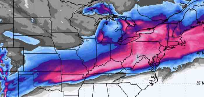
If you went to bed last night feeling confident about where this storm was headed, the overnight runs just scrambled the picture. The European model shifted nearly 200 miles in 12 hours. The GFS came with it. So did the NAM, the ensemble means, and even the AI guidance. When you see that kind of agreement across the board, you have to pay attention.
This doesn’t change the big picture. A major winter storm is still coming Friday through the weekend. We’re still looking at around 160 million people under the gun for wintry precipitation by Sunday morning. Winter Storm Watches now stretch from New Mexico to Tennessee and they’ll keep expanding today.
What’s changed is where the bullseye lands. And for a lot of people in the transition zone, that matters a lot.
Will this shift again? Probably. We’re still 48 to 72 hours out and the northern stream energy hasn’t fully consolidated yet. I expect we’ll see more wobbles in the coming model runs. When that happens, I’ll tell you. That’s how this works. We follow the data where it goes, update the thinking, and keep you informed with each shift. For now, this is where the models are pointing…


What’s Driving The Shift…
Continue Reading— Ryan Hall, Y’all (@ryanhallyall) January 21, 2026